
Images from Our MAGIC Field Trip

The Four Hills Village Project recently had the opportunity to explore the world of historical aerial photography from the mid to late 1900s. Our trip to the Map and Geographic Information Center, also known as MAGIC, at the University of New Mexico allowed us to delve into the area's development history and better understand the surrounding region.

Kimberli using a magnifying glass to get a better look at a high resolution historic map.
Aerial photography in the 1960s was a significant milestone in cartography. The development of advanced cameras and planes capable of capturing high-quality photographs from above allowed for creating detailed maps on a scale never seen before. The pictures could be used to monitor the growth and changes of cities and towns, as well as for scientific research and military purposes.

Schannan Westman Huston. Albuquerque, NM over Four Hills Village. April 16th 1974
During our visit to MAGIC, we had the opportunity to view several large aerial maps of the Four Hills Village development and the surrounding region. With the help of Cheyenne Stradinger, MLIS, the Library Services Coordinator, we explored the basement-level archive at the Centennial Science & Engineering Library. Cheyenne was instrumental in assisting the group, retrieving maps, and providing magnifying glasses to aid in viewing the intricate details of the maps. She also suggested additional resources, such as road maps, fire insurance records, and archives hosted on the campus by the Earth Data Analysis Center (EDAC). We took her up on this, and the EDAC Resource & Information Manager, Sandeep Talasila, GISP, sent us a report on everything he has pertaining to Four Hills between 1957 and 1975. 👌

Limbaugh Engineers Inc. Albuquerque, NM over Four Hills Village. April 3rd, 1966
One of the most exciting aspects of our visit was viewing the changes that occurred over time, from the original houses to the sprawl that followed. The team was amazed at how much the area had changed since the maps were created. The original homes were more rural than expected, and even ten years after the first homes were built, vast land areas remained undeveloped. It was also surprising to see how much of the Earth's natural water flow had been developed over, with entire streams disappearing from the maps.

Several historic maps and large copies stacking up on Cheyenne’s work station.
Aerial photographs can be an essential tool in preserving the history of our communities. They provide an unparalleled perspective on the evolution of land usage, infrastructure, and natural resources. In particular, the maps we discovered could help us get Four Hills Village recognized for its historical significance. Tracing the changes in the landscape and architecture over time gives us a more comprehensive understanding of our community's past.
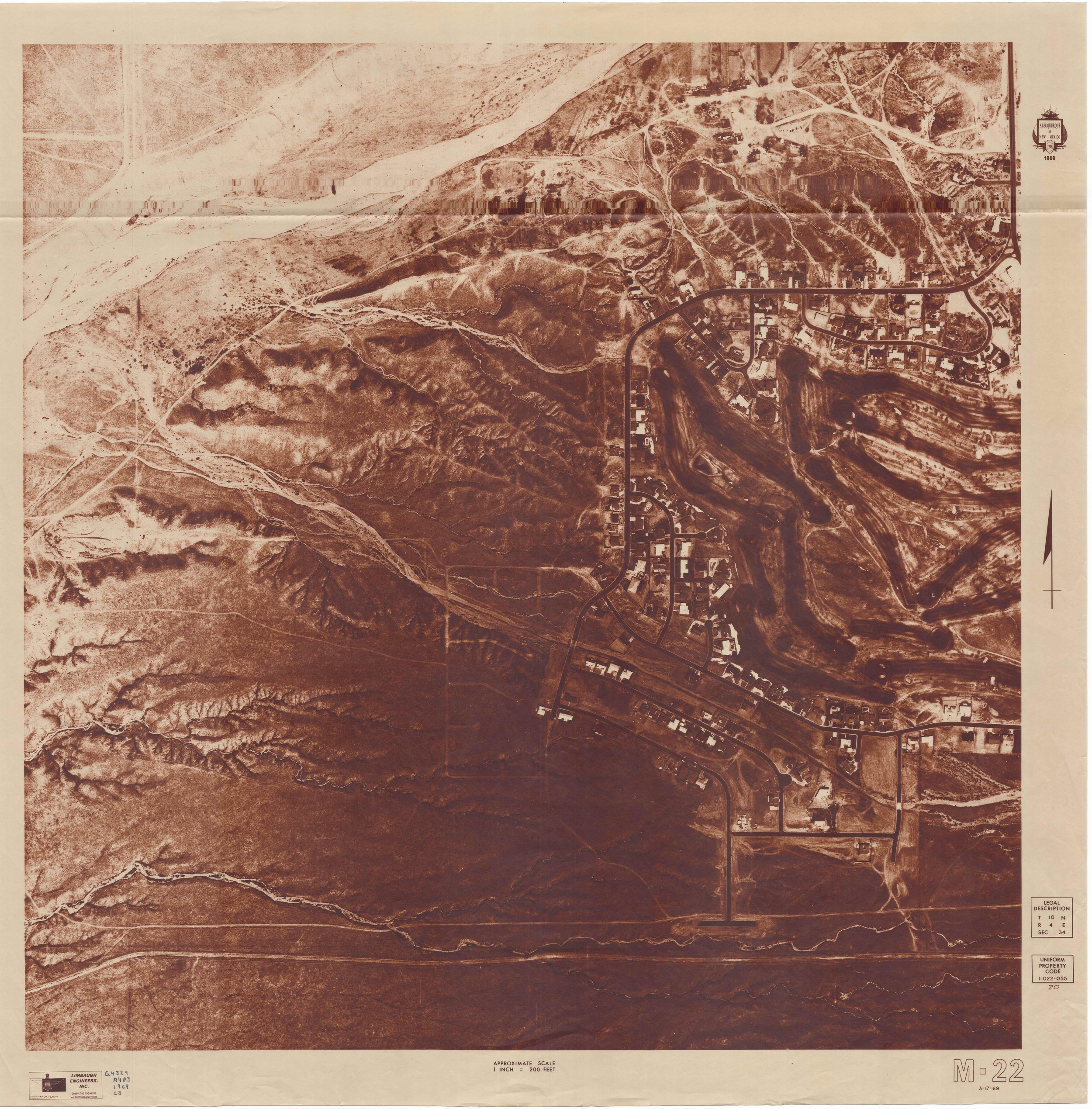
Limbaugh Engineers Inc. Albuquerque, NM over Four Hills Village. March 17th, 1969
Our visit to MAGIC was an eye-opening experience, and we were fortunate to have the chance to work with such knowledgeable and helpful staff. The MAGIC archive provides a wealth of knowledge and is an excellent resource for anyone interested in studying the area's history. We were able to print and digitize our findings, which we are excited to share with others interested in the history of Four Hills Village. The importance of preserving historical records and making them accessible cannot be overstated. We are grateful to have had the opportunity to contribute to this effort and are excited to utilize these new resources for our research.
You’ll be hearing more about these maps soon!!

Scanning in the maps one by one so that we can publish them here on our blog!!


